Parco Archeologico Nazionale dei Massi di Cemmo
Capo di Ponte
The Museum
The Parco Archeologico Nazionale dei Massi di Cemmo (National Archaeological Park of Massi di Cemmo) owes its name to two large boulders, which fell from the rock wall above in the early Holocene period (almost twelve thousand years ago) and were later decorated with etchings depicting human figures, animals, ploughing scenes and carts. From the Copper Age, the surrounding area developed into a megalithic shrine.
The History

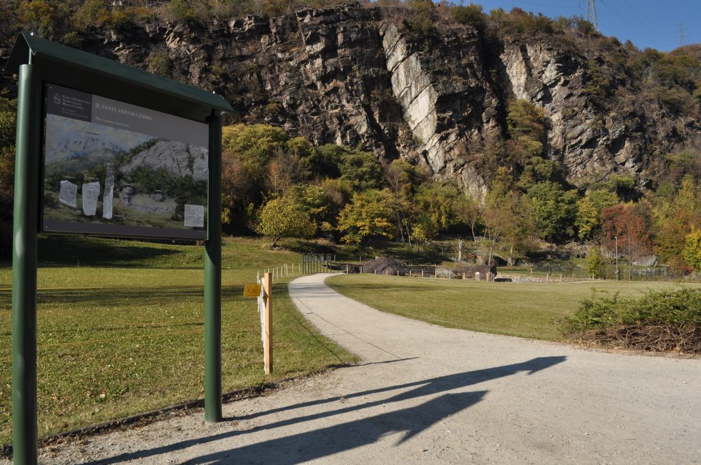
Massi di Cemmo - Ingresso dell'Area
The Parco Archeologico Nazionale dei Massi di Cemmo (National Archaeological Park of Massi di Cemmo) lies in the Pian delle Greppe valley of glacial origin. The area, characterised by the terracing used from the Iron Age onwards for grazing and subsequently for growing grapes and fruit trees, was eventually levelled off in 1970, leading to a dramatic change in its morphology.
For this reason, while planning the Park, between 1998 and 1999 the Superintendence for Archaeological Heritage of Lombardy restored the site, which was inaugurated in October 2005.
The Area

The area around the shrine, the first “camunian” rock art site reported in 1909 by geographer Gualtiero Laeng, was continuously inhabited from the Ancient Mesolithic (9th millennium B.C.) until Roman times. The sacralisation of the area, on the other hand, dates back to the Copper Age (3rd millennium D.C.) and coincides with the appearance of the first rock engravings. Plough furrows were found around them, which, probably, along with the recently discovered steles (not kept on site), formed the boundary of the sacred area.
In the Bronze Age (2nd millennium B.C.) the monumentalisation of the area was completed with the construction of a semi-circular wall which was restored several times between the Iron Age and the Roman era (5th-4th/2nd-1st century B.C.), when an access road to the site was also created. With the advent of Christianity the shrine was dismantled, probably during the struggle against idolatry documented in the Alpine area between the 4th and 11th centuries.
The heritage
The Park, which covers an area of around one hectare, is flat and its paths are equipped and easily suited for persons with reduced mobility. The visit lasts around one hour and access during visiting hours is governed by a video surveillance system with an automatic gate. Around 15 minutes before closing time, a visual signal (flashing light) and acoustic signal indicate to visitors the approaching closing time. Some steles from the shrine, and some more from other Copper Age shrines in Val Camonica are on display in the rooms at the MUPRE. A visit to the Museum is therefore recommended to enhance and complete the visit to the Park.
-

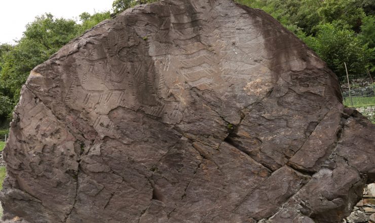
Boulder 1
The boulder was known to the local people as “Preda dei pitoti” (the “puppets stone”), to indicate the engravings. More than one hundred and fifty figures can be found here, including animals, daggers and a ploughing scene. Different stages of the figures on the boulder can be identified from 2900-2500 B.C.
-

Boulder 2
Standing around 15 metres south of Boulder 1, the decorated side of this boulder, dating back to between 2900 and 2500 B.C., is divided into three parts. The engravings include animals, weapons, human figures, a ploughing scene and a four-wheeled cart. A religious meaning is attributed to these two ploughing scenes, linked to rituals to favour soil fertility.
-

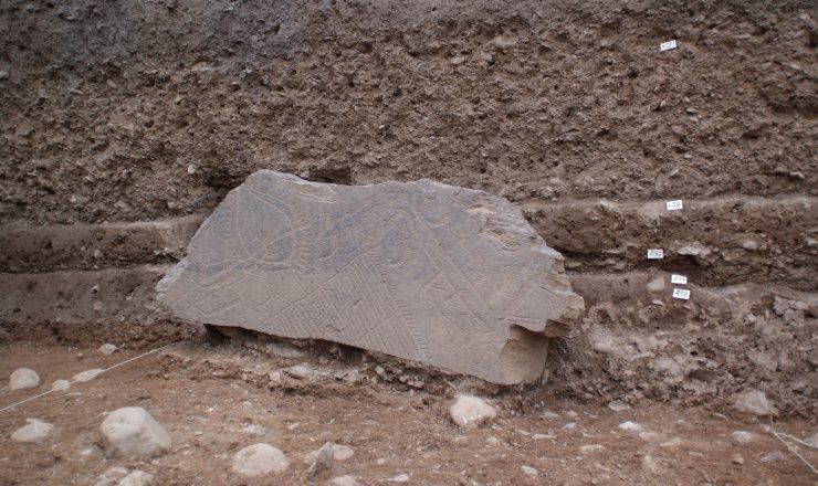
Boulder 20
A large monumental fragment dating back to the second half of the 3rd millennium B.C. shows some special engravings which belong to three phases. A fragment of human skull was also placed in front of it, suggesting the presence of an ancestral bone manipulation ritual.
Address
Località Cemmo
25044 Capo di Ponte
Ownership
Ente MiC
Tipology
Archaeological Park